Resources
Images & Maps
Download the images and the maps, or view them in this online library.
Images
-
 Tratado de Tordesilhas. Courtesy of the Biblioteca Nacional de Lisboa, Mss. 5, no. 25
 -
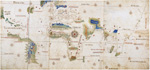
 Map of Mesoamerica
 -
 Portrait of John Smith from an engraving
 -
 Portrait of Pocahontas from an engraving
 -
 John Lawson Awaits his Death, Tuscorora War. Drawing by Baron Christoph von Graffenried. Image courtesy of North Carolina State Archives, Division of Archives and History
 -
 The Old Plantation, probably South Carolina, c.1790–1800. Watercolor on paper. 11–11/16 x 17–7/8 inches. Abby Aldrich Rockefeller Folk Art Museum, Williamsburg, Va. 1935.301.3. Acc. #1935.301.3
 -
 Stowage of the British Slave Ship Brookes, c.1790. Broadside, Rare Book Room, Library of Congress, Portfolio 282–43, Courtesy: Jerome S. Handler
 -
 Virginian luxuries. Abby Aldrich Rockefeller Folk Art Museum, Colonial Williamsburg Foundation, Williamsburg, VA [1991.100.1]. Image ID 1991.100.1
 -
 Joist Hite and Braddock historical marker. Reprinted with permission of the Historical Marker Database
 -
 Dasseins de Sauvages de Plusieurs Nations. Courtesy of the Peabody Museum of Archaeology and Ethnology, Harvard University, 41–72–10/20
 -
 Sir William Johnson, Major General of the English forces in America. Mezzotint by Spooner 1756, after T. Adams, Courtesy of the Library of Congress Prints and Photographs Division, LC–USZ62–2695
 -
 A view of the taking of Quebeck by the English forces commanded by Gen. Wolfe, Sep: 13th, 1759. Courtesy of the Library of Congress Prints and Photographs Division, LC–USZ62–47
 -
 Paul Revere, The Bloody Massacr. From the Collections of the William M. Clements Library, University of Michigane
 -
 The Emblem of ingratitude a true relation of the unjust, cruel, and barbarous proceedings against the English at Amboyna in the East-Indies, by the Netherlandish governour & council there : also a farther account of the deceit, cruelty, and tyranny of the Dutch against the English, and several others, from their first to their present estate, with remarks upon the whole matter : faithfully collected from antient and modern records. London: Printed for William Hope, 1672, Beinecke Rare Book and Manuscript Library, Yale University, B1580, [15], 93 p.
 Tratado de Tordesilhas. Courtesy of the Biblioteca Nacional de Lisboa, Mss. 5, no. 25
 Map of Mesoamerica
 Portrait of John Smith from an engraving
 Portrait of Pocahontas from an engraving
 John Lawson Awaits his Death, Tuscorora War. Drawing by Baron Christoph von Graffenried. Image courtesy of North Carolina State Archives, Division of Archives and History
 The Old Plantation, probably South Carolina, c.1790–1800. Watercolor on paper. 11–11/16 x 17–7/8 inches. Abby Aldrich Rockefeller Folk Art Museum, Williamsburg, Va. 1935.301.3. Acc. #1935.301.3
 Stowage of the British Slave Ship Brookes, c.1790. Broadside, Rare Book Room, Library of Congress, Portfolio 282–43, Courtesy: Jerome S. Handler
 Virginian luxuries. Abby Aldrich Rockefeller Folk Art Museum, Colonial Williamsburg Foundation, Williamsburg, VA [1991.100.1]. Image ID 1991.100.1
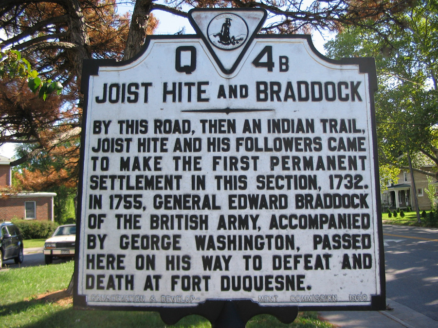 Joist Hite and Braddock historical marker. Reprinted with permission of the Historical Marker Database
 Dasseins de Sauvages de Plusieurs Nations. Courtesy of the Peabody Museum of Archaeology and Ethnology, Harvard University, 41–72–10/20
 Sir William Johnson, Major General of the English forces in America. Mezzotint by Spooner 1756, after T. Adams, Courtesy of the Library of Congress Prints and Photographs Division, LC–USZ62–2695
 A view of the taking of Quebeck by the English forces commanded by Gen. Wolfe, Sep: 13th, 1759. Courtesy of the Library of Congress Prints and Photographs Division, LC–USZ62–47
 Paul Revere, The Bloody Massacr. From the Collections of the William M. Clements Library, University of Michigane
 The Emblem of ingratitude a true relation of the unjust, cruel, and barbarous proceedings against the English at Amboyna in the East-Indies, by the Netherlandish governour & council there : also a farther account of the deceit, cruelty, and tyranny of the Dutch against the English, and several others, from their first to their present estate, with remarks upon the whole matter : faithfully collected from antient and modern records. London: Printed for William Hope, 1672, Beinecke Rare Book and Manuscript Library, Yale University, B1580, [15], 93 p.
Maps
-
 Cantino World Map. Anonymous, Cantino World Map (1502), Biblioteca Estense, Modena, Italy
 -
 Waldseemuller Cosographia map close up with America. Courtesy of the Library of Congress, American Memory Collection, g3200 ct000725
 -
 Map by Nicola van Sype. Courtesy of the Library of Congress, American Memory Collection, g3201s rb000011
 -
 Herrerra Map. Courtesy the Library of Congress, Division of Geography and Maps, g3290m gct00084
 -
 Map of the British and French Dominions in North America (1757). Mitchell Map, A Map of the British and French Dominions in North America (1757), Library of Congress, Geography and Map Division.
 -
 A New Map of the North Parts of America Claimed by France. Popple, “A Map of the British Empire in America,” Hargrett Rare Library Map Collection, University of Georgia, Map 1733a P6a
 -
 Catello Plan for New Amsterdam in 1660. Redraft of the Castello Plan New Amsterdam in 1660, 1916, Courtesy of the New York Historical Society Maps Collection
 -
 Progress of army from landing till taking possession of Philadelphia. Courtesy of the Library of Congress, g3791s ar106100
 -
 Vingboons Map: New England and Virginia. Courtesy of the Library of Congress, g3300 ct001068
 -
 Oronce Fine's Cordiform map of the World, 1531. Courtesy of the Rare Book and Special Collections Division, Library of Congress (147.03.00)
 -
 A map of the British and French settlements in North America. Courtesy the Library of Congress, Division of Geography and Maps, g3300 ar000500
 -
 United States and southeastern Canada, 1758. Courtesy the Library of Congress, Division of Geography and Maps, g3300 ct001109
 -
 Slave factories, or compounds, maintained by traders from four European nations on the Gulf of Guinea in what is now Nigeria. Courtesy of the Library of Congress, Miscellaneous Items in High Demand Collection, LC-USZ62-106828
 -
 A Map of the British Empire in America. Popple, “A Map of the British Empire in America,” Hargrett Rare Library Map Collection, University of Georgia, Map 1733a P6a
 Cantino World Map. Anonymous, Cantino World Map (1502), Biblioteca Estense, Modena, Italy
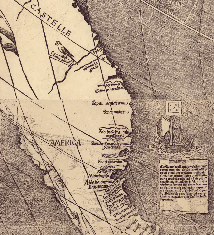 Waldseemuller Cosographia map close up with America. Courtesy of the Library of Congress, American Memory Collection, g3200 ct000725
 Map by Nicola van Sype. Courtesy of the Library of Congress, American Memory Collection, g3201s rb000011
 Herrerra Map. Courtesy the Library of Congress, Division of Geography and Maps, g3290m gct00084
 Map of the British and French Dominions in North America (1757). Mitchell Map, A Map of the British and French Dominions in North America (1757), Library of Congress, Geography and Map Division.
 A New Map of the North Parts of America Claimed by France. Popple, “A Map of the British Empire in America,” Hargrett Rare Library Map Collection, University of Georgia, Map 1733a P6a
 Catello Plan for New Amsterdam in 1660. Redraft of the Castello Plan New Amsterdam in 1660, 1916, Courtesy of the New York Historical Society Maps Collection
 Progress of army from landing till taking possession of Philadelphia. Courtesy of the Library of Congress, g3791s ar106100
 Vingboons Map: New England and Virginia. Courtesy of the Library of Congress, g3300 ct001068
 Oronce Fine's Cordiform map of the World, 1531. Courtesy of the Rare Book and Special Collections Division, Library of Congress (147.03.00)
 A map of the British and French settlements in North America. Courtesy the Library of Congress, Division of Geography and Maps, g3300 ar000500
 United States and southeastern Canada, 1758. Courtesy the Library of Congress, Division of Geography and Maps, g3300 ct001109
 Slave factories, or compounds, maintained by traders from four European nations on the Gulf of Guinea in what is now Nigeria. Courtesy of the Library of Congress, Miscellaneous Items in High Demand Collection, LC-USZ62-106828
 A Map of the British Empire in America. Popple, “A Map of the British Empire in America,” Hargrett Rare Library Map Collection, University of Georgia, Map 1733a P6a